
Images


April 9, 2023 - Contrails Crisscross the Iberian Peninsula
 Tweet
Tweet
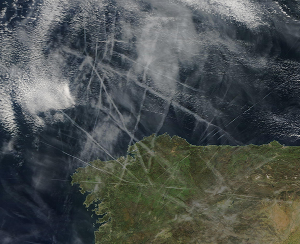
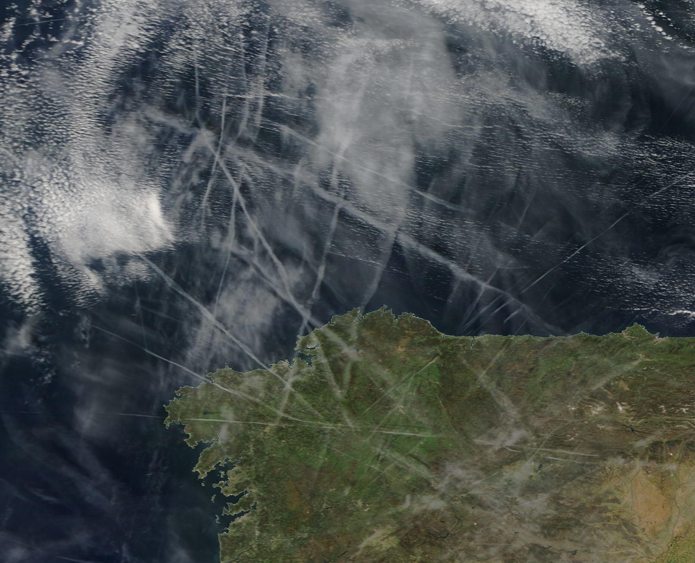
Long streaks of cloud crisscrossed the skies over the Iberian Peninsula on April 7, 2023. The Moderate Resolution Imaging Spectroradiometer (MODIS) on board NASA’s Terra satellite acquired a true-color image of the complex pattern on that same day.
The streaks are a type of cirrus cloud known as a “contrail”. Cirrus clouds typically form in the sky when humidity is high, but contrails form in the wake of passing aircraft due to particles and water vapor contained in their exhaust. The temperature and humidity of the air affects how long contrails last. When air is dry, contrails last just seconds or minutes. But when the air is humid, contrails can be long-lived. Young, freshly formed contrails appear like neat line, with sharp and distinct sides. As contrails age, they spread outward until they become difficult to distinguish from naturally occurring cirrus clouds.
The complex set of contrails captured in this image are a mix of both young and older contrails that have formed in the wake of many different aircraft. Near the right side of the image, a few thin lines stretch from the northeast to the southwest, marking the youngest contrails. The majority, however, are older and appear as thick gray lines over the North Atlantic and passing over the coast of Spain. A group of fuzzy cloud-like areas located inland are likely older contrails, while broad swaths of white over the North Atlantic are banks of clouds.
Image Facts
Satellite:
Terra
Date Acquired: 4/7/2023
Resolutions:
1km (274.3 KB), 500m (670.1 KB), 250m (455.6 KB)
Bands Used: 1,4,3
Image Credit:
MODIS Land Rapid Response Team, NASA GSFC
